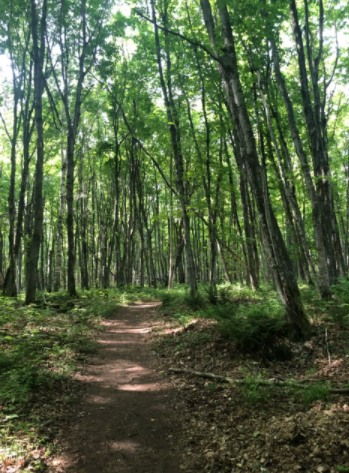
Running trails are a sanctuary. Jr. Kaia Denhof and Jr. Abby Green scoured Ottawa County to find the best running trails.
Number 1: Pigeon Creek Park
Located off of Stanton Street is an expansive park with 282 acres of trails. Pigeon Creek Park is popular year round. In the summer, runners, bikers, hikers, and horseback riders take to the intricate trails. In the winter, Pigeon Creek offers a great cross-country ski course.
Navigability ★★★★☆ (4/5)
The park is easy to navigate. There are trail maps located at each trail crossing, and each trail is individually marked to eliminate any confusion. There are two different trail maps: one for winter and one for summer. Both maps are easy to comprehend because the different routes are marked by distance and color.
Terrain ★★★★★ (5/5)
The terrain is exceptional. The trails are made of packed dirt and are wide enough to fit three people across comfortably. Most of the trails are flat with an occasional incline, allowing runners to either increase or decrease the difficulty of their run. Along the Pigeon River, the trail becomes a system of boardwalks, which adds a change of scenery without compensating the footing.
Popularity of the Park: Moderate
People are often scattered throughout the park, but not to the extent that the trails feel crowded.
Number 2: Riley Trails
Just off Riley Street in the northwest corner of Park Township lies Riley Trails, a popular destination among bikers, hikers, and runners. While the large parking lot often looks full, especially in the morning and late afternoon, a spot is usually open.
Navigability ★★★★★ (5/5)
The trails are clearly marked, and easy-to-read maps are located throughout the park. Every map shows the mountain bike trails and hiking trails. The difficulty level of the terrain, bridge, changes in terrain, “you are here” arrow, and individual trails are all obviously marked on the maps. The individual trail number signs are scattered throughout the trail system to give one an indication of what trail they are on and allow them to plan their route more strategically.
Terrain ★★★★☆ (4/5)
The terrain is customizable to a runner’s skill level. Along the outer rim of the park are flat trails, but the middle and back sections have a few rigorous hills. Most of the trails have hard and compact footing, which is ideal for running. However, in the middle of the park lies a dune, which makes those trails incredibly sandy.
Popularity of the Park: High
The trails are often filled with people. Mornings and afternoons are increasingly busy, with many people sneaking in a workout before or after work. Bikers zip through the trails, so stay alert and aware. It is also important to stay cautious for hikers as they roam the trails. The trails are usually not too congested because of the size of the park itself, but never assume the trail is desolate.
Number 3: Hemlock Crossing
Hemlock Crossing is next to US 31 along the Pigeon River. It offers many opportunities for outdoor activities such as cross-country skiing, hiking, running, and kayaking. The park has modern restrooms that are open seasonally to the public. There are also two extensive parking lots, so parking is typically not an issue.
Navigability ★★☆☆☆ (2/5)
The trail maps are fairly informative, but there are very few of them actually on the trails. Because of the curvy shape of many of the trails and lack of trail maps, it is difficult not to get lost. Each trail is numbered, but without a trail map to see where the trail leads, runners are forced to memorize a route ahead of time. The length of the trail itself is also missing from the trail maps, making it hard to plan out a specific route.
Terrain ★★★★☆ (4/5)
Paths and dirt trails compose the Hemlock Crossing trail system. The paved paths are wide, extending throughout the wetland. The dirt trails had a tolerable amount of roots and sporadic narrow sections. Some sections of the forest trails included hills, but they are gentle slopes. Both the paved paths and dirt trails had good footing and are overall pleasant to run on.
Popularity of the Park: Low
The trails are not overcrowded with other hikers and runners. Every once in a while there is another runner or hiker, but most of the trails are wide enough that it is not a problem.
Number 4: Saugatuck Dunes
Saugatuck Dunes sits in between the lakeshore and the historic Felt Mansion. The vast trail system attracts both runners and hikers. During the winter months, parking is not a problem because of the large parking lot located right next to the trailhead. However, during the summer months, there are a sizable number of beachgoers, making parking scarce.
Navigability ★☆☆☆☆ (1/5)
The quality and quantity of the trail maps is laughable. The trail maps portray the four loops in a simple outline with minimal trail markers. While running, getting lost is inevitable. The few trail markers provide no guidance due to the lack of trail maps. On the trails, a few measly signs mark where each of the four loops is located. Nonetheless, staying on the specific trail loops is strenuous because of completely unmarked trails.
Terrain ★★★☆☆ (3/5)
The trails mainly consist of dirt paths except for parts of the beach loop that have sandy trails. Overall, the beach loop did not have ideal running trails due to the sand, but the footing on the north trail, specifically, is satisfactory. Roots cover some sections of the trails, so it is crucial to pay attention to foot placement in order to avoid an accident. Some hills have steep inclines and declines, which make the terrain more difficult.
Popularity of the Park: Moderate
The park has a moderate amount of visitors all year round, with summer being the busiest month. With that being said, the trails do not easily get overcrowded, especially the lesser known trails: the south and north loops.
Number 5: Upper Macatawa Greenway Trail
The Upper Macatawa Greenway Trail system is located in Zeeland Township. This 612 acre property is dedicated to runners, mountain bikers, and hikers alike. Because of its proximity to the I-196 freeway, the park has an urban feel to it, which differs from other parks around Ottawa County.
Navigability ★★☆☆ (2/5)
A few simple trail maps are dispersed throughout the park, but not an adequate amount. At several places where trails intersect there is no map to be found, nor are the individual trails marked, making it extremely difficult to navigate through the park.
Terrain ★★☆☆☆ (2/5)
The terrain of the trails is diverse. The park is equally made of forest and wetland, providing a multiplicity of running surfaces. These surfaces consist of wood boardwalks, natural surface, paved path, and mountain bike trails. While there are many running surfaces, the paved path is the only ideal surface to run on. The trails in the forest are extremely narrow, with sharp turns and gradual inclines and declines, which made it impossible to maintain a consistent pace. In the wetland trails, pools of water covered entire parts of the trail with no way around them.
Popularity of the Park: Low
The trail is typically deserted with the occasional hiker, biker, or runner.


